Jelgava from Above
Jelgava Municipality, Latvia, November 2017
Google Maps, Yandex.Maps
Today is a selection of photographs of Jelgava from above. To deal with the factory defect of a shaking camera on the Mavic, I had to take several shots from each angle, but even with that, some still didn't turn out well. In total, 4 launches were made—near Rastrelli Palace, in the centre, near St Anna's Church, and near the neighbourhood where we lived. There weren't enough batteries for more, as they run down quite quickly.
Latvia has very reasonable rules for drones. Lightweight drones do not require registration. You cannot fly within a 5-kilometre radius of airports, over government or military facilities, higher than 120 metres, or over crowds of people, and you must stick your name and contact details on the drone. If you do not violate these rules, no permits or approvals are needed. A huge contrast with all kinds of authoritarian-police countries like Russia and Belarus, or countries where privacy laws reach the point of absurdity, like Austria and Sweden.
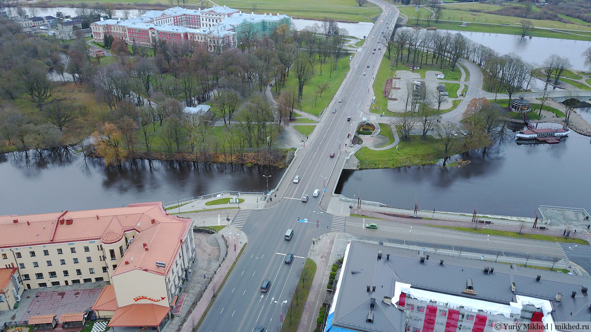
The Rastrelli Palace from a slightly different angle than in the last story. Part of it is under renovation. By the way, notice that the rear wing differs noticeably from the rest of the palace in style. This is because it was built later in the 20th century, between 1936 and 1939, on the site of the former ducal stables. Such extensions are a bad idea, but alas, they didn't understand this back then, nor do they now.
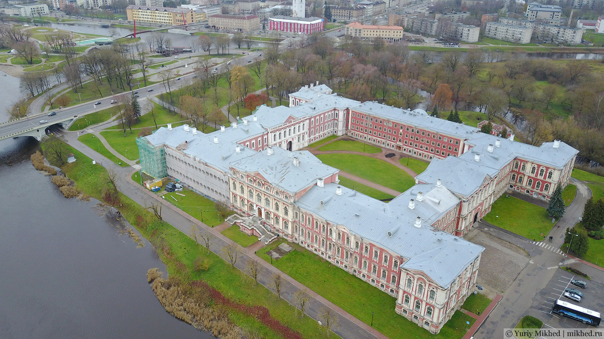
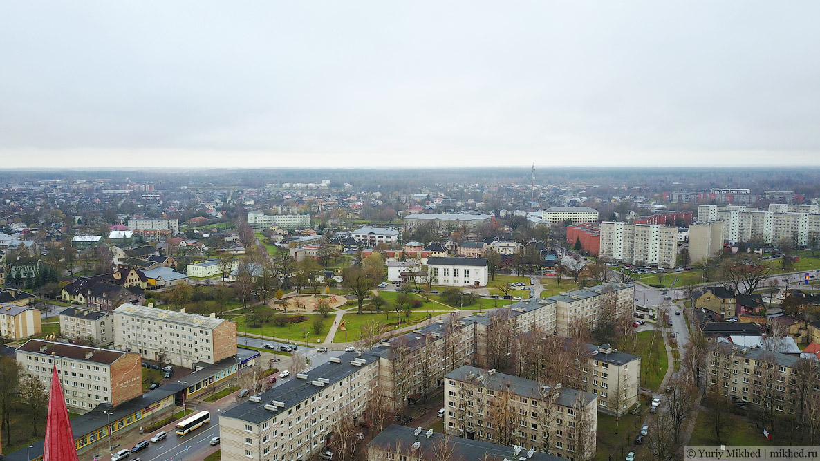
Behind the palace is the Driksa River (a branch of the Lielupe), and further on is the town. In the right part of the image, you can make out the town market and the "Tonuss" shopping centre (in the past it housed baths and a swimming pool, now it's only shops).
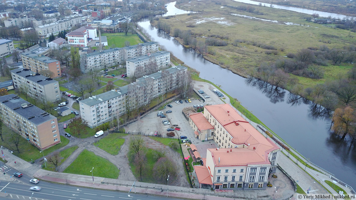
The island itself is barely built up because it is frequently flooded. The building at the very bottom is the "Jelgava" hotel, built in 1938.
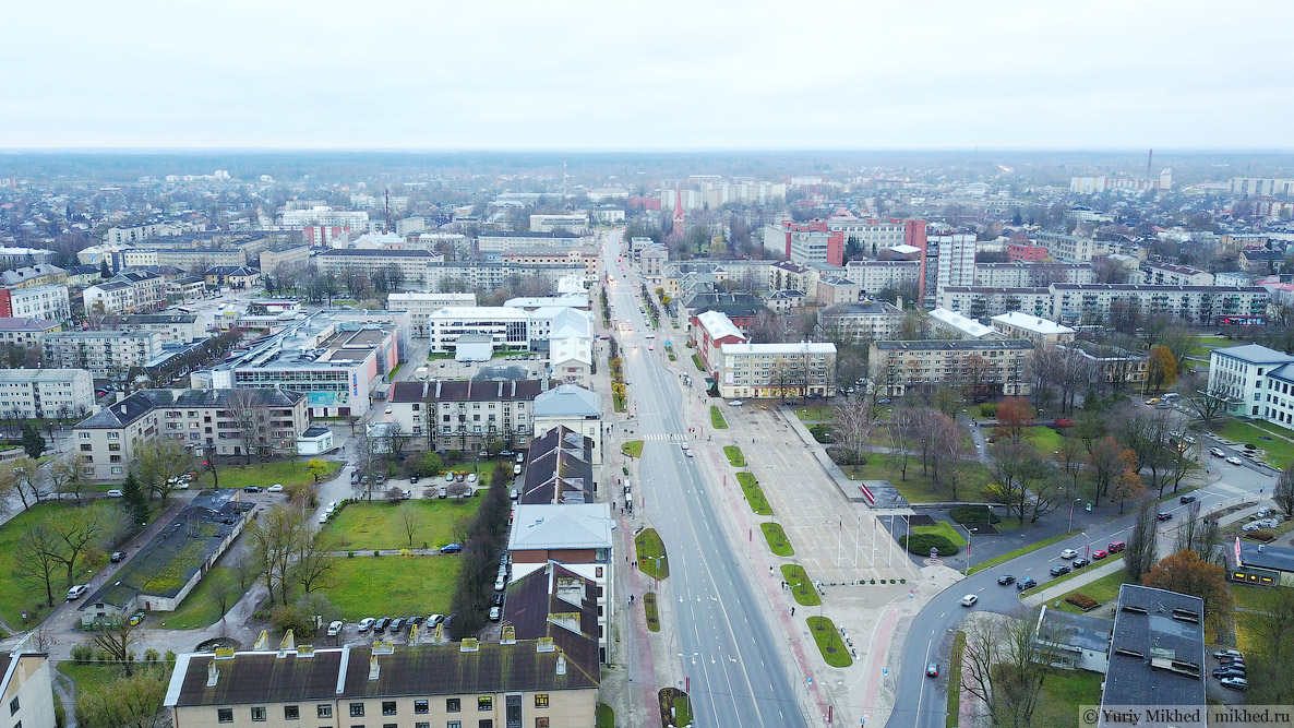
The centre and the main entrance to Jelgava. That's the next point of our launch.
The main street is called "Lielā iela", which literally means just "Big Street". In Soviet times it was called, of course, Lenin Street, and a monument to the leader of the proletariat stood in the main square. In 1991, the monument was promptly dismantled, and the square received its pre-war name of Duke Jacob (Hercoga Jēkaba laukums), in honour of Jacob von Kettler (1610–1682), under whom the Duchy of Courland, whose capital was Mitau, reached the pinnacle of its might.
Tā izskatās Jelgava no putna lidojuma augstuma (šis teikums ir paredzēts attēlu meklētājprogrammām).
If you turn to the north and look closely, an airfield can be seen in the background. Uzvaras Street is visible below.
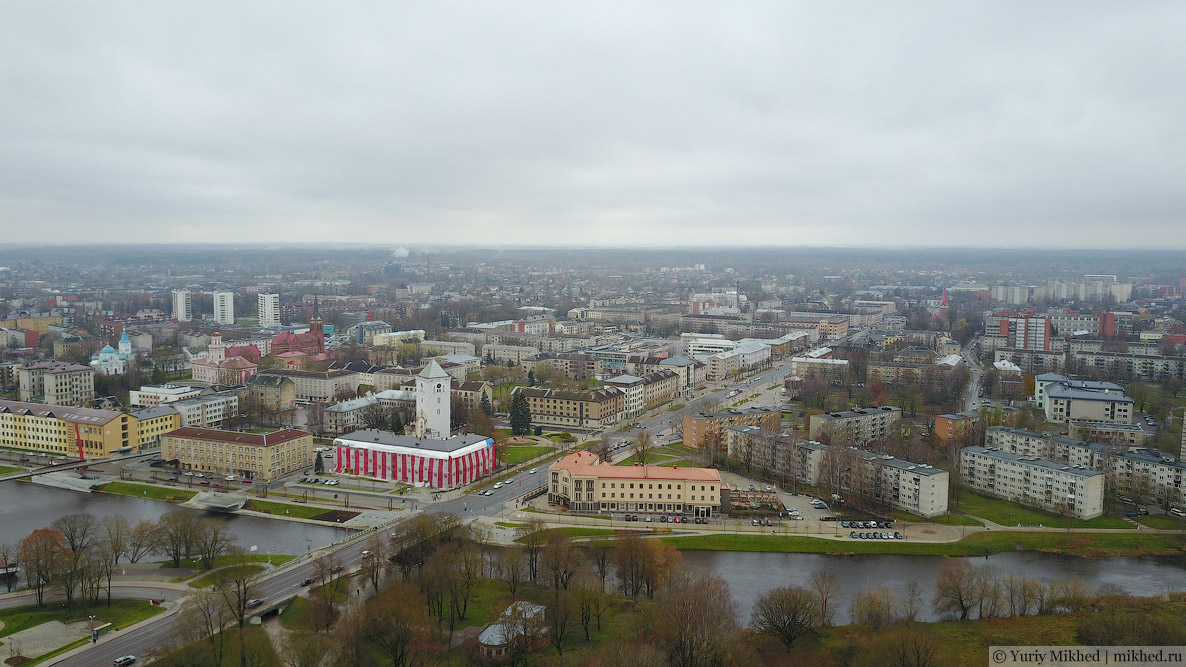
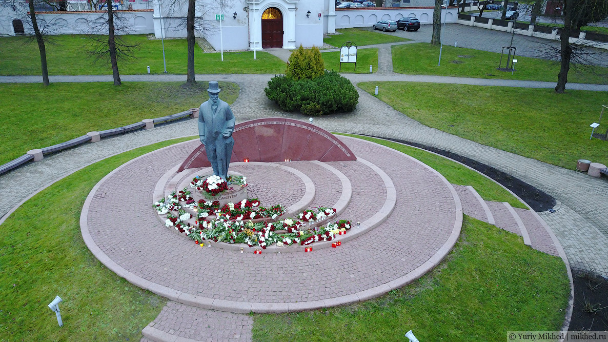
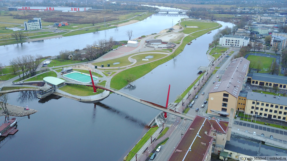
I already showed the view in the other direction in the last story. A beautiful new embankment, a pedestrian bridge, and the surviving tower of the destroyed Holy Trinity Cathedral. Near the tower is a monument to Jānis Čakste.
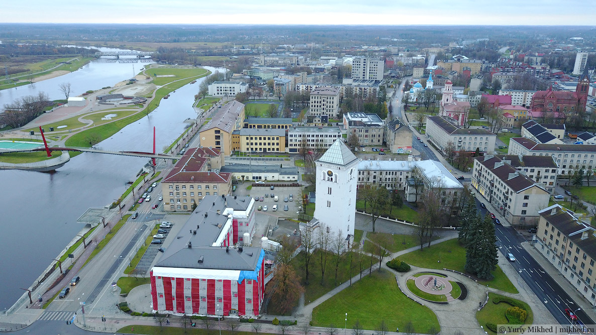
Čakste was the very first president of Latvia, holding this office from 1918 to 1927. Two more presidents followed him, and in 1934 a coup d'état took place, establishing the authoritarian regime of Kārlis Ulmanis, which existed until the annexation of Latvia by the Soviet Union.
The suspension pedestrian bridge. A railway bridge is visible in the distance.
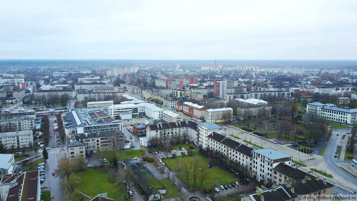
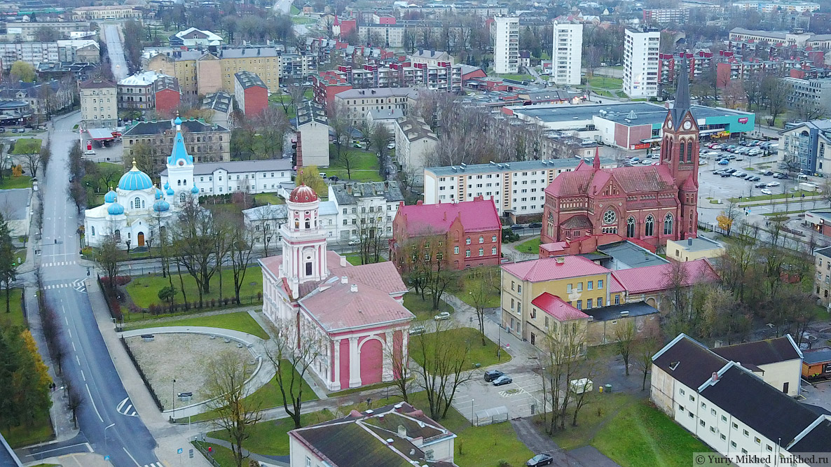
Further to the right, two churches and the Academia Petrina are clearly visible. In the distance on the left side of the image, you can see the railway station.
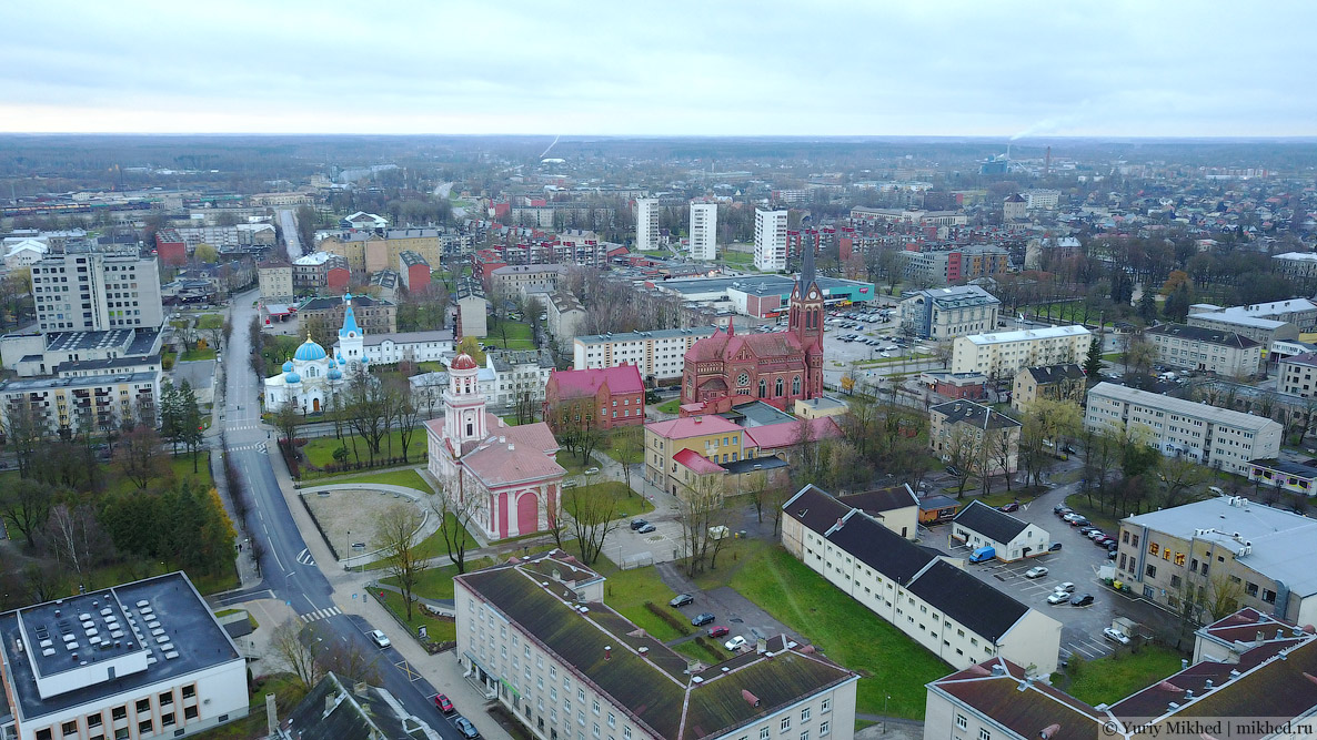
A closer look at the historical buildings.
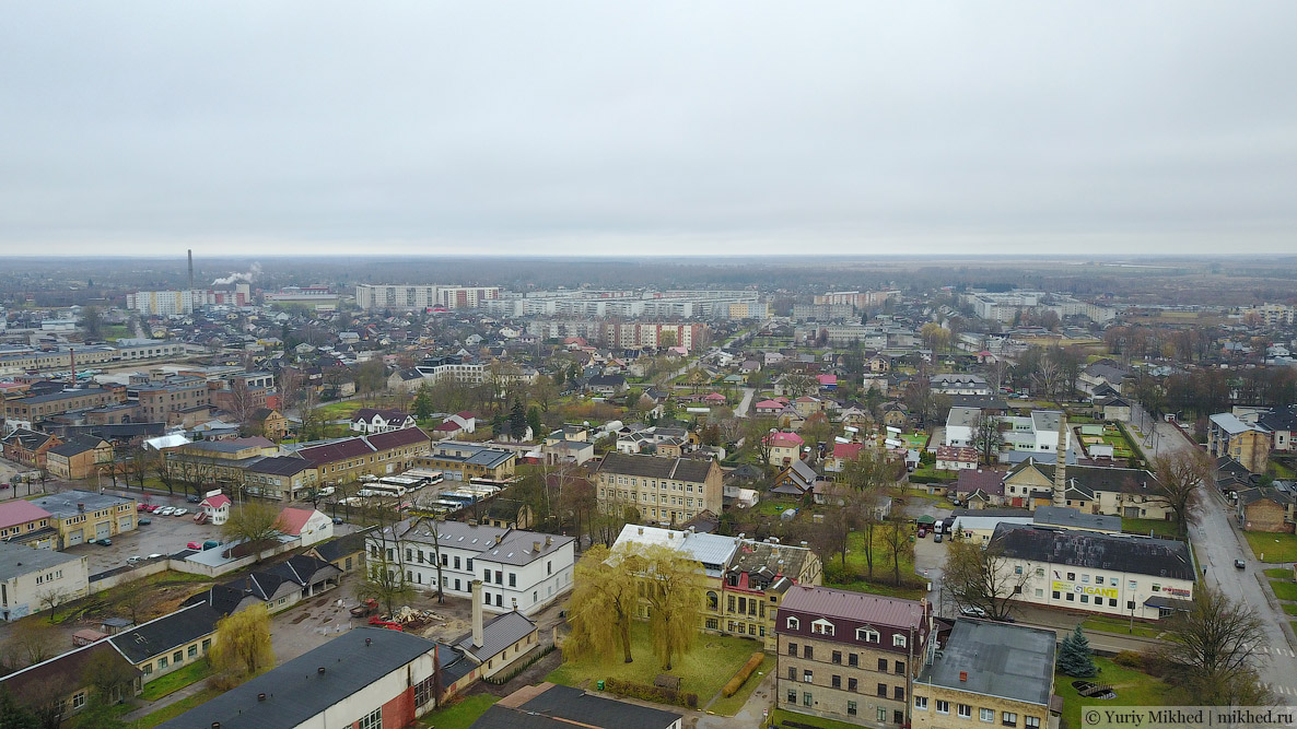
The palace park is left behind. Further on, the road goes to Riga, passing through the RAF microdistrict, which was once built specifically for the workers of the Soviet automotive giant.
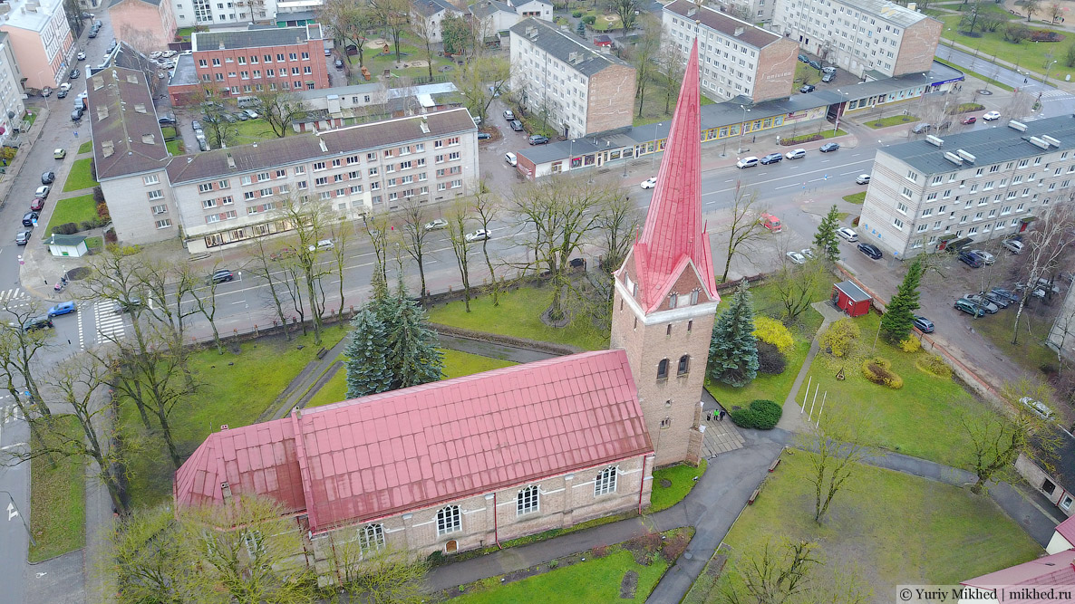
Now let's move over to St Anna's Church. The cathedral, built under Duke Friedrich in 1641, is the oldest in the town. The main street runs behind it, and the shop in the five-storey block near the crossing was one of my most coveted places in childhood because it sold toys.
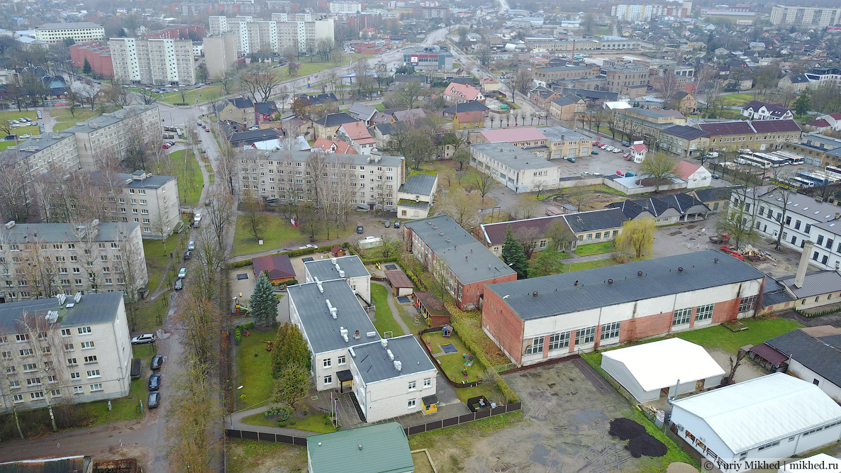
If you turn slightly to the right, you can see my nursery school—there it is, below. The nursery was called "Zvyozdochka" (Little Star), in Latvian—"Zvaigznīte", and it was mostly attended by the children of Soviet military personnel living in the town. A bit further away, you can see a large number of small historical houses; this is that preserved old street, photos of which were also shown in the last story. In the distance on the right, the tannery is visible.
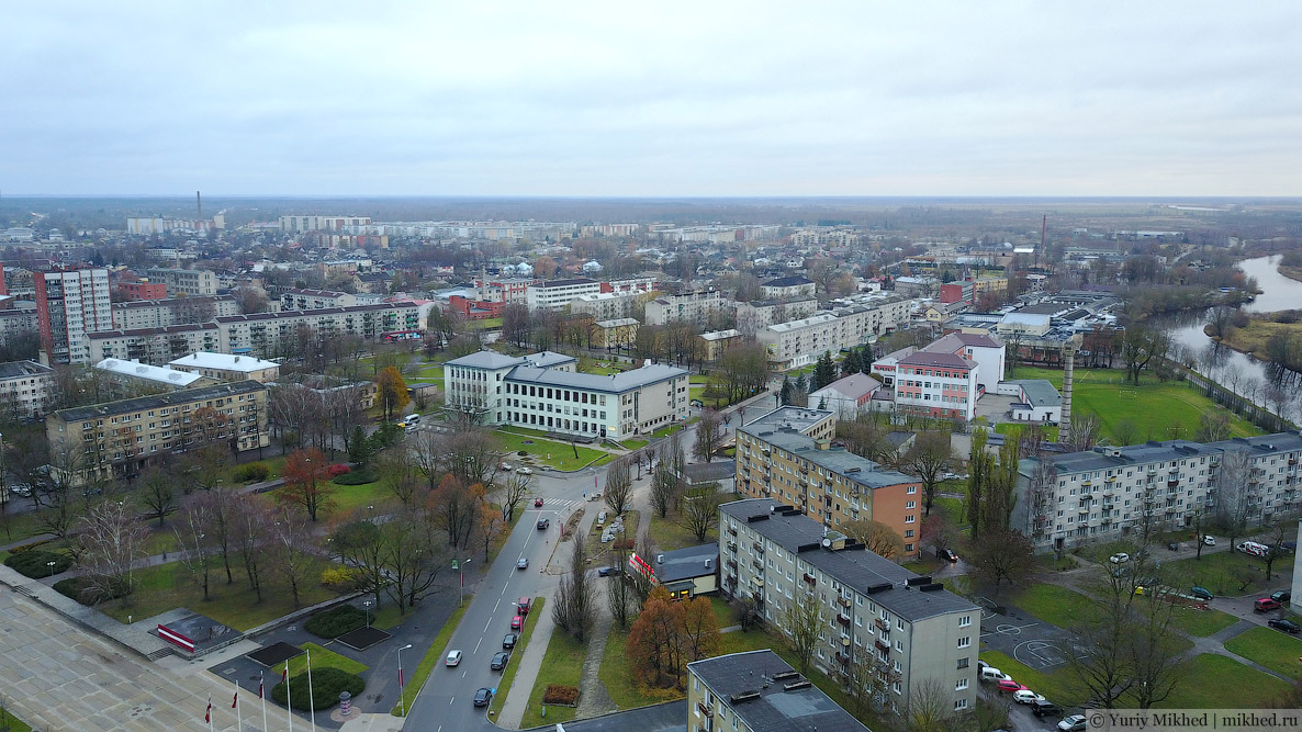
And this is the view from the same point towards the centre (the Holy Trinity tower is clearly visible in the middle). In the lower left corner, you can see the roofs of the Jelgava engineering plant buildings. After the collapse of the USSR, the plant managed to survive in the new conditions and still produces industrial lubrication equipment.
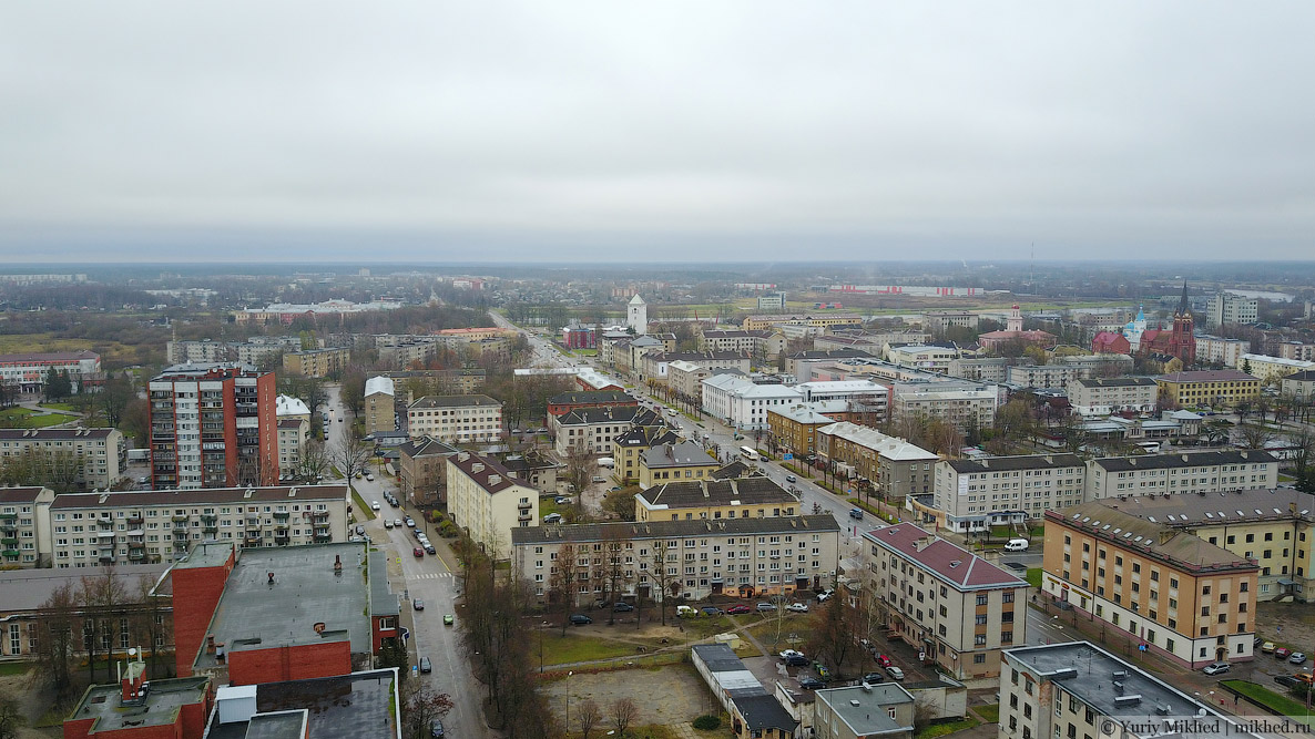
If you look in the other direction, there is the Oak Square (Ozolskvērs), named so in honour of the ancient oak tree growing in the middle. The oak can be seen right in the centre of the shot. Directly above it, you can make out a white three-storey building with a grey sloping roof—that used to be my primary school.
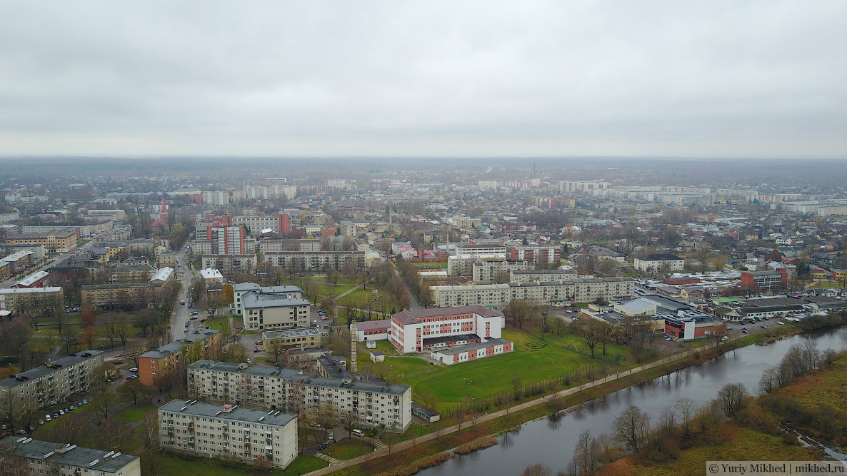
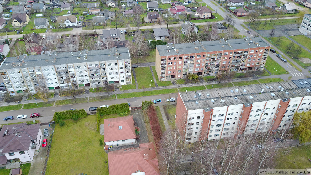
In the distance, you can see the Satiksme microdistrict, as well as the 3 five-storey blocks standing separately amidst the private residential sector where we lived. Let's move over there.
Our street, Lidotāju iela. Translated from Latvian, its name means "Pilots' Street". These 3 five-storey blocks were mostly inhabited by people who were somehow connected to the Jelgava military airfield. We lived first in the first building on the right, and in 1986 we moved to the left one.
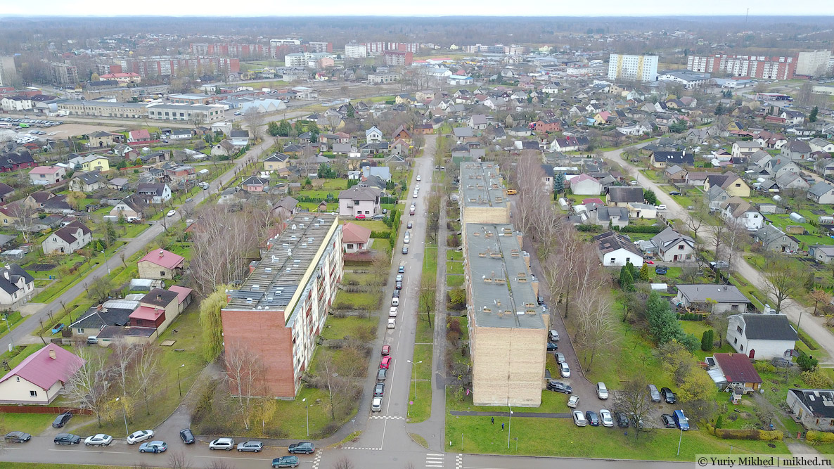
These five-storey blocks were surrounded on all sides by the private residential sector. But while everyone in the apartment blocks was Russian-speaking, the private houses belonged to Latvians. Now it feels strange to think that despite the close proximity, there was a certain estrangement between us and the Latvian children; we didn't play with them, and they didn't play with us, and if we had to cross paths, it was only by chance—for example, if a ball flew into their yard. It just so happens that some people create artificial barriers, while others perceive them as something natural, without thinking that all these barriers are invented and imposed. After all, in reality, we all have much more in common, and mutual understanding is always found very quickly and easily if you want to and try to find it.
Behind our five-storey block, there used to be a wasteland that we called "the swamp". "The swamp" was one of our main places for hanging out. If my childhood memory serves me right, in the mid-eighties there were still old private houses there, then for some reason they were abandoned and gradually demolished. Now "the swamp" has been built over anew, and the wasteland is no more.
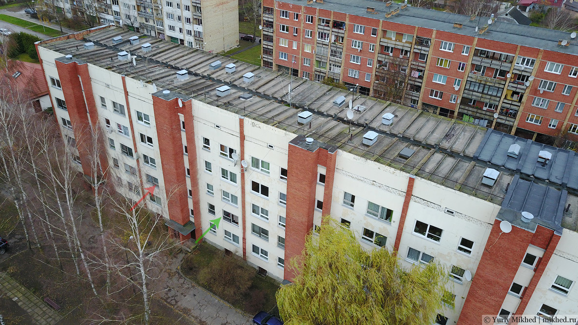
Our courtyard and building. The green arrow indicates the flat where we lived from 1986 to 1991, and the red one—from 1991 to 1996.
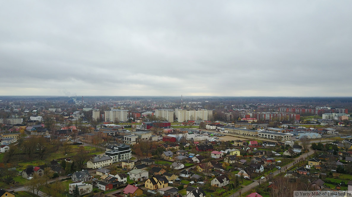
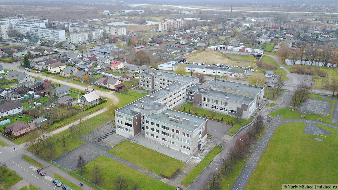
Right next to our houses was the Latvian Secondary School No. 1 (now the Jelgava Secondary School of Technologies). The school is notable because it was there in 1989 that the most successful rock band in the history of Latvia was born—Prāta vētra, known outside the country as Brainstorm. The group took 3rd place at Eurovision 2000 and is now popular not only in Latvia but also in Europe and Russia (you can often hear their Russian-language songs on "Nashe Radio", they periodically appear in various TV shows and give concerts). Prāta vētra (the name translates as "brain storm") was created by five friends who were in the upper grades of this school. Today, 4 members remain, as one of the musicians tragically died in 2004. In general, I recommend listening to them—the music is of very high quality and the songs have meaning.
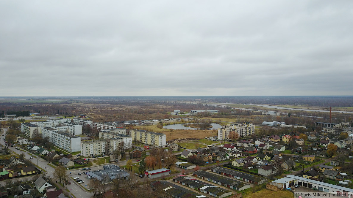
Behind the school in Soviet times, there was a military construction unit. And further up Meiju ceļš street (in Soviet times—Dzilnas iela) there was a grocery shop, visible here in the lower left part of the image (now there is a "Maxima", which is a Lithuanian supermarket chain). The round lake with an island in the distance was dug out in the nineties; previously there was a swamp there. Behind the lake is a garage complex, where my dad's garage used to be. The woods on the left side of the image used to be the airfield.
As you can see, I am already halfway into my childhood memories here, and the next story will be exactly about them.